New Hampshire River Maps Project
From Ireland to Idaho, and from the Test to the Tongariro, world-class trout fishing has been invigorated over the past decades by conservation efforts with regards to fish policy and management. Sadly, our own backyard backdrop of the beautiful White Mountains in New Hampshire lacks this prestige due, in large part, to a lack of conservation practices and awareness. These are the rivers that once made up the Great Native American Highway and were often the settings for Kenneth Roberts novels.
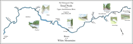
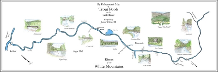
In an effort to raise awareness and respect for New Hampshire’s mountain streams as fishing destinations, a series of maps that identify trout pools with illustrated vignettes were created. These are designed less for topographical accuracy, and more as a series of artistic renderings that may be displayed at a camp or mountain home. Elevating the region’s image as a destination for trout fishing, it is hoped, will help both the tourism economy and encourage the more progressive and sustainable conservation policies that are practiced elsewhere.
This is an on-going project with maps of the Gale and Upper Ammonoosuc Rivers complete. The project will ultimately include the lower Ammonoosuc, Upper Connecticut, Pemigewasset and Adroscoggin Rivers, encompassing the major rivers of northern New Hampshire. The intent is to make these available through retail outlets or fishing organizations.

